See crop stress from space before you see it from the truck.
Satellite and thermal scouting for Southeast cotton, peanut, soybean and corn. Every week you get a map and an email or text that names the stressed zone, the likely cause, and a date to check it by.

How it works
Map your fields
Send us your field boundaries and crops: cotton, peanut, soybean or corn.
Fresh imagery ~every 5 days
We pull free Sentinel-2 and Landsat satellite passes and NOAA weather for each field.
Stress indices per field
We compute NDVI (vigor), NDRE (canopy nitrogen/chlorophyll) and thermal stress, and flag zones that fall behind.
Weekly map + alert
A map plus an email/text naming the stressed zone, the likely cause and a check-by date.
Sample report EXAMPLE DATA
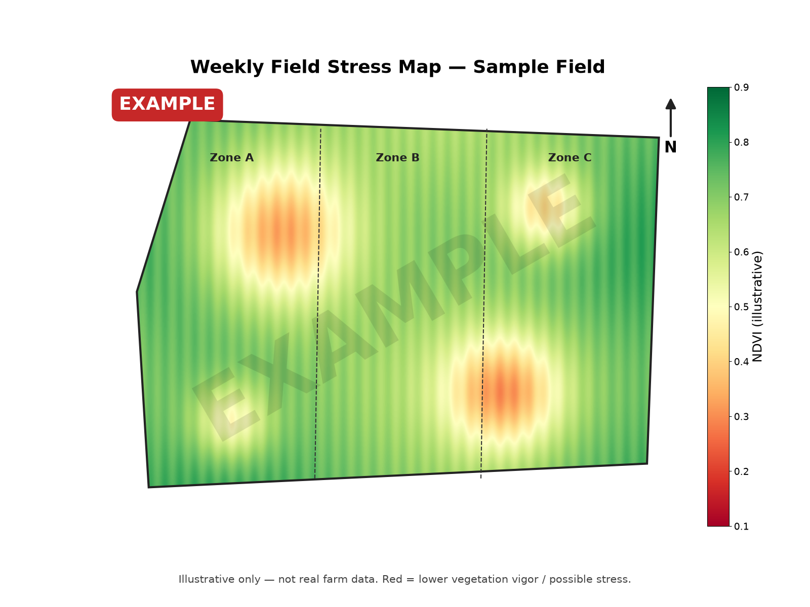
EXAMPLE DATA — illustrative only, not a real field or customer.
| Field | Example Field 7 — Cotton |
|---|---|
| Stressed zone | NE corner, ~12 ac |
| Signals | NDRE down vs. field average; canopy running warm on thermal |
| Weather context | NOAA: no measurable rain in 10 days |
| Likely cause | Moisture stress (possible nitrogen shortfall) |
| Check by | Thursday |
| Next step | Walk the zone, or book a $300 drone follow-up |

Pricing
Direct
Weekly maps and alerts for your own acres.
$1,000 per-farm minimum (250 acres).
Start DirectFor co-ops and ag retailers
Offer satellite scouting to your growers under your own name. At $2.50/acre bulk, we run the imagery and analysis. Your agronomists get the weekly maps and alerts to act on, and your growers see your brand.
- White-label maps and email/text alerts
- Cotton, peanut, soybean and corn
- Drone follow-ups and yield-loss reports available as add-ons

Contact
Email corner.co.haney@gmail.com or use the form.